
Known for its erratic weather, White Mountain National Forest has some of the highest peaks in New England and exists primarily within the bounds of New Hampshire, but a small sliver extends into Maine. The second highest wind on the surface of Earth (231mph) was recorded here at Mount Washington in the Presidential Range. With 1,200 miles of hiking trails as well as numerous campgrounds, ski areas, snowmobile trails, and lakes and rivers for fishing, there's something here for every outdoor enthusiast.
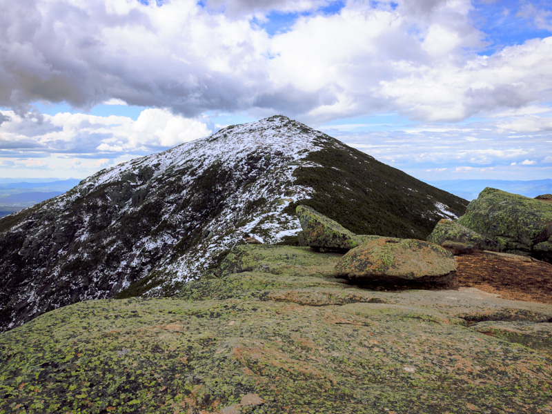
A view of Mount Lafayette from the ridge.
The Franconia Ridge loop is one of the most popular trails in the area for a reason. After trekking through the forest along a river featuring numerous waterfalls, you ascend the ridge and have panoramic views for a large portion of the hike, tackling Little Haystack Mountain and Mount Lincoln before finally reaching Mount Lafayette and descending past Greenleaf Hut, which operates during the summer and offers a full-service kitchen and bathroom for hikers, as well as bunk beds for overnight stays. The ranger recommended doing the loop counterclockwise, taking the Falling Waters trail up and descending back down along the Old Bridal Path, which is highly advisable for safety reasons. There's a few steep, wet and potentially slippery scrambles along the Falling Waters trail that are not fun to climb down, especially towards the end of the hike when you're low on energy. This is a difficult all-day hike, but so worth it.