
Red River Gorge lies within Daniel Boone National Forest and is nearby to Natural Bridge State Resort Park. It's free to enter and has the second most arches in the United States, being surpassed only by Arches National Park in Utah. Most of the popular trails range from easy to moderate, with only a few requiring longer scrambles or the usage of a rope. Cell reception on the trails is poor but still usable.
A view of Double Arch from Auxier Ridge.
If you only have time for one hike in Red River Gorge, make it this one! I recommend doing the longer loop version of the trail that includes Double Arch. It forks off the main loop so check your maps to make sure you don't miss it. The hike itself is moderate and takes 3-4 hours, with expansive views along Auxier Ridge and at Double Arch. This trail is along the same road as Gray's Arch, which is only about an hour hike with minimal elevation gain, so it's easy to do both at the same time.
NOTE: Nada Tunnel Road does not lead to Auxier Ridge, despite what Google Maps GPS says. Make sure you take Tunnel Ridge Road (also not closed in April, despite what Google Maps says) to get there. If you're having trouble getting the GPS to route you the correct way you can set it to Gray's Arch Recreation Area and drive to the end of that road to get there. There are no intersections or alternate routes, so it's impossible to get lost!
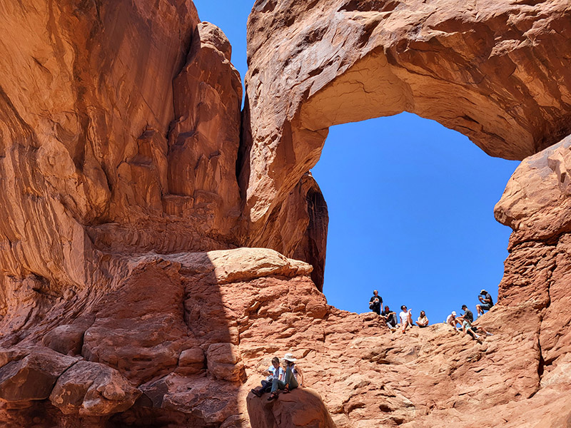
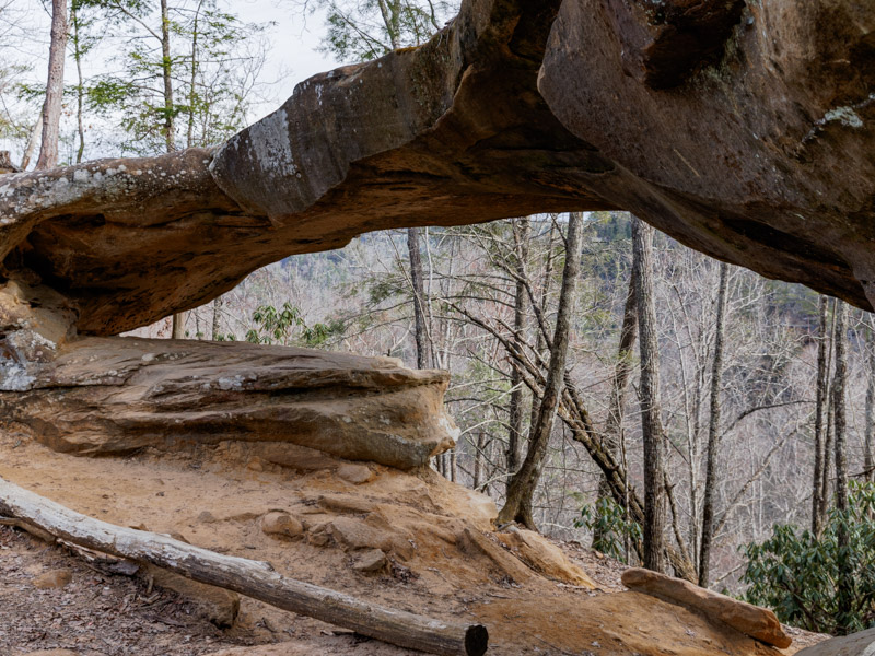
Climbing on this thing felt like being back at Double Arch in Utah.
The photos don't do this one justice. Being a fan of rock arches, and having spent a short amount of time in Arches National Park, I found this arch just as cool as any I saw in Utah. It's a great bang-for-your-buck viewpoint hike, since can be done in under an hour. Elevation gain is minimal— there's just a couple staircases at the end. This trail is close to Auxier Ridge and Hanson's Point which are also great longer hikes if you want to extend your day.
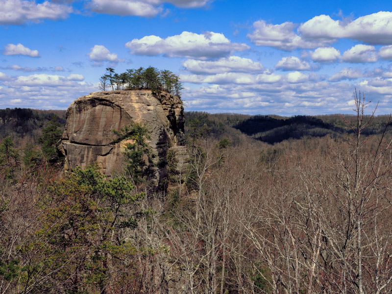
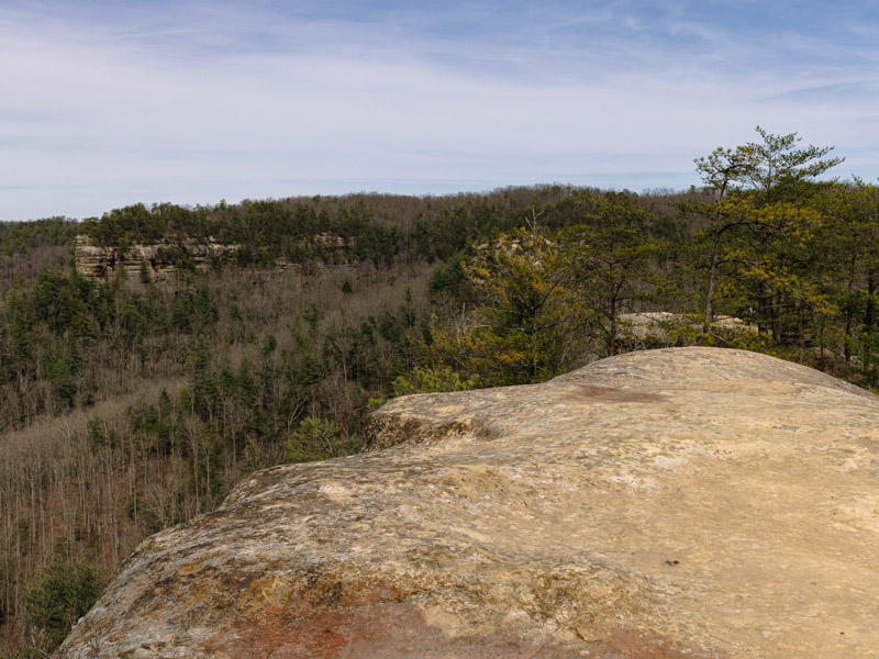
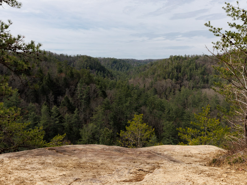
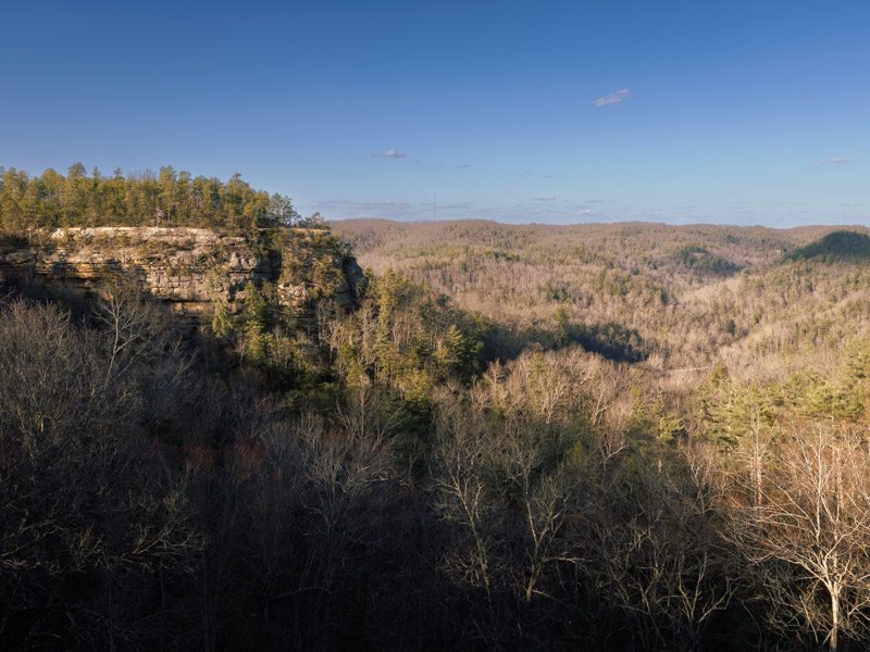
Hanson's Point is visible across the valley.
This is more of a viewpoint than a hike since it only takes about 15 minutes out and back, but it's a great one. At the other side of the valley, along the ridge, you can see Hanson's Point. Chimney Top Rock shares a parking lot with Princess Arch which is another short walk, so you can easily see both at once. This is definitely an essential Red River Gorge viewpoint, along with Sky Bridge.
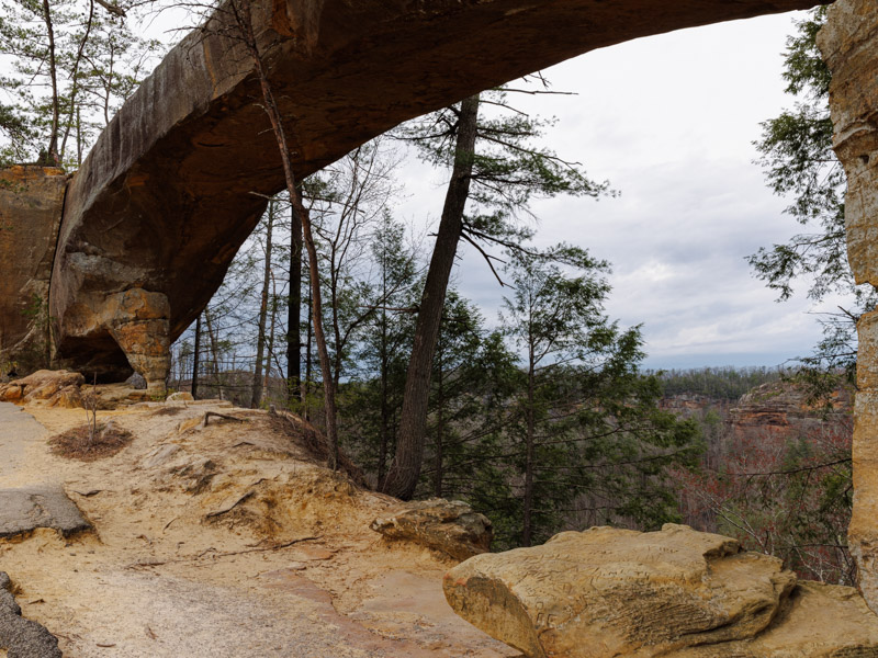
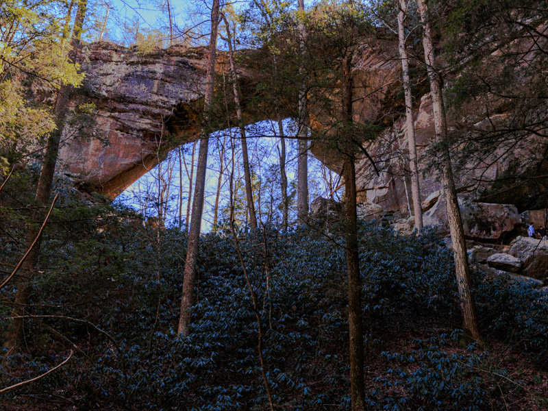
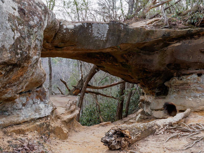
Underneath Sky Bridge.
Sky Bridge is one of the most popular trails in the area for a reason. It's a large and impressive arch only a few minutes from the parking lot, which you reach after walking along the top of the arch with its panoramic views and then down some steps. It's not as steep or narrow as it looks in the photo, so don't worry if you're afraid of heights! Multiple people can comfortably walk abreast on top of the arch.
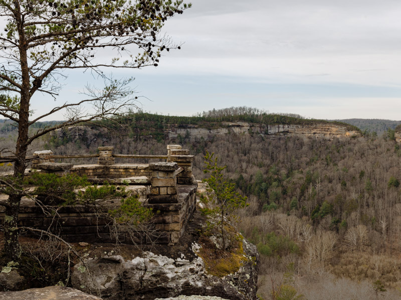
The overlook at Hanson's Point.
There's a few different trails that lead to Hanson's Point. We took the Rush Ridge to Hanson's Point Loop variation to extend the hike and avoid the river crossings of Rough Trail. The views are mostly forested and don't become interesting until the end, so I recommend doing the Pinch-em Tight version of this hike if you're short on time. The rock staircase can become very slippery after rain, and the area around the cave a muddy bog, so bring waterproof boots. This trail is just down the road from Gray's Arch, an excellent option to check out as well.

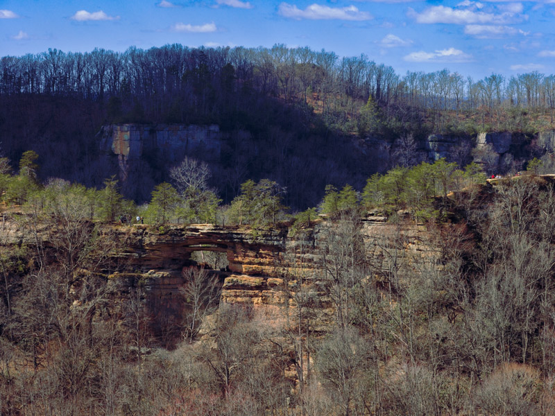
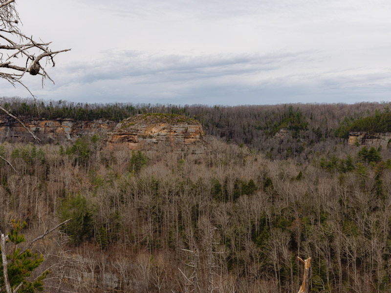
Indian Staircase with its scramble in the distance.
Is it overrated? Yes and no. The terrain on the hike itself is very enjoyable, rivaled only by Auxier Ridge, but the final viewpoint isn't as spectacular as some of the other trails here since it's more closed in and not as panoramic. It's possible to skip the steep scramble if you do the trail as an out-and-back rather than a loop, going clockwise along the Sheltowee Trace Trail at the fork, which we did, since rain was looming in the area. This hike can be combined with the popular Cloud Splitter Trail, also requiring scrambling.
This trail shares the same parking lot as Chimney Top.
This is another viewpoint that only takes about 15 minutes round trip, and while I wouldn't recommend going to see it by itself, it's worth stopping at if you're going to Chimney Top Rock, which shares the same parking lot. The view here isn't as impressive as other spots because it's a smaller arch and very closed in by trees, but it's still a cool area to walk around.
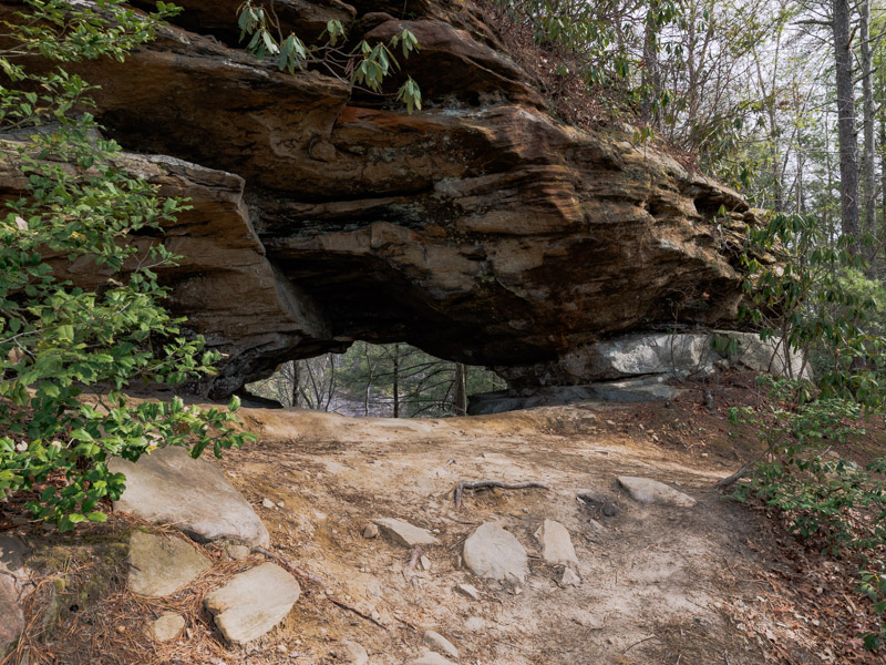
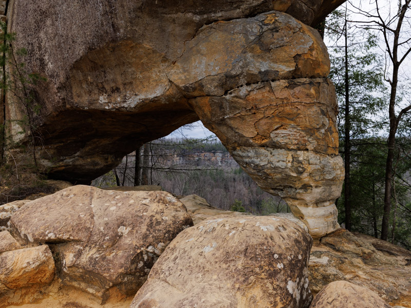
The overlook is just opposite the arch.
Whistling Arch is a short walk and just a few minutes down the road from the Sky Bridge Trail. The arch itself is small and I found the rock shelter and ledge overlook at the end of the trail more interesting than the actual arch. If you're short on time you can safely skip this one even on the way to Sky Bridge. There's plenty of other similar or better overlooks in the area.
The overlook is directly off the side of the road.
I found out about this spot by complete accident on Google Maps. You can stop along the way to Sky Bridge or Whistling Arch since it's only a few minutes down the road, but there's nothing spectacular here, so I recommend giving it a pass.
Natural Bridge State Resort Park technically isn't part of Red River Gorge, but it's so close by and geographically similar it might as well be. Entrance is free, and many of the trails are centered around the large sandstone arch from which the park takes its name. There's also an optional (paid) skylift that will take you to the top of Natural Bridge if you're incapable of hiking to it. It runs from the first weekend in April until the last Sunday in October.
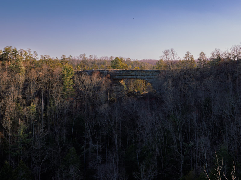
Natural Bridge seen from Battleship Rock.
Despite its short length of just over an hour, this was one of my favorite hikes in the area. After a short jaunt in the forest you ascend Natural Bridge and walk along a ridgeline to Battleship Rock for a better view of the bridge. There are a few different trails leading to these areas. We took the one including Devil's Gulch.